Paddleboarding spots in Argyll and Bute
104 launch spots across Argyll and Bute
Explore our top picks in Argyll and Bute
Browse the launch spots on this weekend’s page
Every mapped spot in Argyll and Bute
Zoom in to split a cluster; open a pin for the spotMap of every spot in Argyll and Bute
The interactive map opens on any device with JavaScript. The full list of launch spots is below.
Launch spots
Showing 24 of 104 Sea
Largiemore put-in
Argyll and Bute, ScotlandThis is a slipway on the B8000 shore road on Loch Fyne, on the Cowal peninsula about 1.5 kilometres north of Otter Ferry Pier. Loch Fyne is a tidal sea loch that runs roughly 65 kilometres inland from the Sound of Bute, making it the longest sea loch in Scotland, and it is designated a Nature Conservation Marine Protected Area.
 Sea
Toward put-in (Port Lamont)
Argyll and Bute, ScotlandThis slipway sits about 65 metres from another harvested put-in, close to the hamlet of Port Lamont within Toward on the Cowal peninsula, facing the Firth of Clyde.
 Sea
Kames put-in
Argyll and Bute, ScotlandKames is a shoreline village on the Cowal Peninsula, on the West Kyle of the Kyles of Bute immediately south of Tighnabruaich. The mapped slipway gives access to this narrow, sheltered channel between the mainland and the Isle of Bute, a stretch long used by yachts and paddle steamers.
 Sea
Imeraval put-in (Port Ellen)
Argyll and Bute, ScotlandThis slipway sits on Pier Road in the hamlet of Imeraval, on the shore of Port Imeraval on Islay's south coast, about a mile west of Port Ellen. The shoreline continues west into Kilnaughton Bay.
 Sea
Bruichladdich Pier slipway
Argyll and Bute, ScotlandThis slipway sits at Bruichladdich Pier, on the shore of Loch Indaal in the village of Bruichladdich on the Rinns of Islay. The Loch Indaal Way footpath runs along this stretch of shore toward Port Charlotte.
 Sea
Gigha Ferry Slip
Argyll and Bute, ScotlandThis is the CalMac ferry slipway on Ardminish Bay, Isle of Gigha, the island terminal for the short crossing to Tayinloan on the Kintyre mainland. There is no terminal building, but the council provides toilets by the slip, and watersports equipment can be hired close by.
 Sea
Ganavan Slip
Argyll and Bute, ScotlandA slipway at Ganavan Sands on the northern edge of Oban, opening onto Ganavan Bay towards the Firth of Lorn, beyond the sheltered horseshoe of Oban Bay itself.
 Sea
Ferry Pier
Argyll and Bute, ScotlandA slipway pier at Lagg on Jura's east coast, launching onto the Sound of Jura opposite Knapdale on the mainland. Lagg was once the terminus for a drovers' ferry to Keillmore, using a slipway and pier built in 1810 to ship cattle across for mainland markets.
 Sea
Ferry Cottage put-in (Clachan)
Argyll and Bute, ScotlandThis slipway sits on the West Loch Tarbert shore at Portachoillan, a small hamlet a few miles from Clachan village, named after the nearby Ferry Cottage property that marks a former ferry crossing point. West Loch Tarbert is a sea loch running south-west from Tarbert towards open water near the Sound of Gigha.
 Sea
Feolin Ferry slipway
Argyll and Bute, ScotlandA slipway at Feolin Ferry on Jura's southwest shore, launching onto the Sound of Islay opposite Port Askaig on Islay. The sound carries strong tidal currents, strong enough that a tidal-energy array was approved for the site in 2011, and is used daily by the Jura to Islay vehicle ferry.
 Sea
Falls of Lora
Argyll and Bute, ScotlandTidal rapids at the narrow mouth of Loch Etive, under Connel Bridge near North Connel. The rapids form as the sea level in the Firth of Lorn falls faster than the loch behind a rocky sill, most pronounced for a few days either side of spring tides, and the site is used by whitewater kayakers.
 Loch
Eredine put-in
Argyll and Bute, ScotlandEredine is a small settlement on the western shore of Loch Awe, Scotland's longest freshwater loch, in Argyll and Bute. A slipway gives access to the loch here; Eredine was formerly a scheduled stop for a steamer service that also called at Portsonachan, Taycreggan and Ford.
 Sea
North Pier slipway, Oban (south)
Argyll and Bute, ScotlandA concrete slipway on the Oban harbour front a few metres from another mapped slip near North Pier, on the sheltered water of Oban Bay.
 Sea
North Pier slipway, Oban
Argyll and Bute, ScotlandA concrete slipway on the harbour front at North Pier, launching into the inner harbour of Oban Bay, a busy working port for CalMac ferries.
 Sea
Ganavan Sands slipway
Argyll and Bute, ScotlandA second slipway about 100 metres west of Ganavan Slip, on the same Ganavan Sands beach north of Oban.
 Sea
Dunollie slipway, Oban
Argyll and Bute, ScotlandA slipway on Corran Esplanade in the Dunollie area of Oban, on the sheltered horseshoe of Oban Bay.
 Sea
Corran Esplanade slipway, Oban
Argyll and Bute, ScotlandA slipway on Corran Esplanade in Oban town centre, on the sheltered water of Oban Bay a short walk from the harbour and North Pier.
 Sea
Rothesay slipway (Albert Place)
Argyll and Bute, ScotlandThis slipway is on Albert Place in central Rothesay, on the east coast of the Isle of Bute, fitted with a cable winch rated to 2.5 tonnes. It opens onto Rothesay Bay on the Firth of Clyde, which served as a wartime anchorage for the submarine depot ship HMS Cyclops.
 Sea
Rhubodach ferry slipway
Argyll and Bute, ScotlandThis slipway serves the short car-ferry crossing at Rhubodach, on the north tip of the Isle of Bute, across the Kyles of Bute to Colintraive on the Cowal mainland. Caledonian MacBrayne's crossing here is about 450 metres, among the shortest ferry routes still operating in Scotland.
 Sea
Culwatty put-in (Helensburgh)
Argyll and Bute, ScotlandThis slipway lies on the Gare Loch shore between Rhu and Helensburgh, close to the loch's mouth at the Rhu Narrows where it opens into the Firth of Clyde.
 Sea
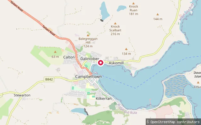
Askomill slipway, Campbeltown
Argyll and Bute, ScotlandA slipway reached by a short service road in the Askomill area on the north side of Campbeltown, on the shore of Campbeltown Loch. OSM records it as fee-free. The original harvested name pointed inland to Crosshill Farm and Crosshill Loch, a separate freshwater reservoir south of the town that has no connection to this coastal launch point.
 Sea
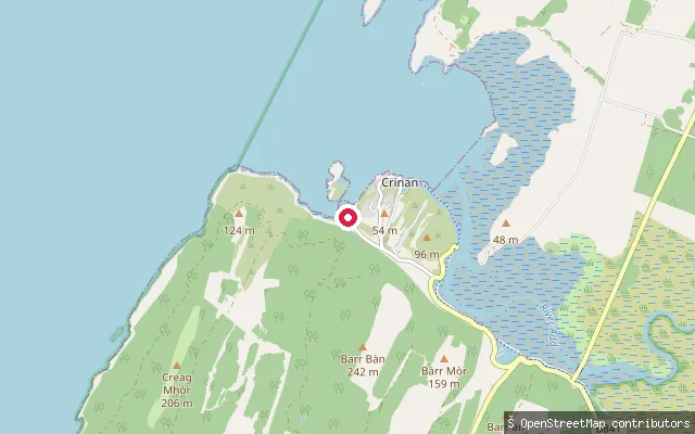
Crinan put-in
Argyll and Bute, ScotlandCrinan stands where the Crinan Canal meets Loch Crinan, a sea loch opening onto the Sound of Jura. A public slipway sits by the harbour close to the Crinan Boatyard, with views across the sound to the Hebridean islands. The Crinan Harbour Association also runs a pontoon and slipway for visitors on an honesty-box donation basis.
 Sea
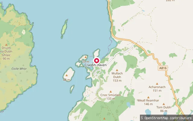
Craobh Haven put-in
Argyll and Bute, ScotlandThis slipway is part of Craobh Haven Marina, a leisure marina built in the early 1980s by joining a group of small islets with causeways, opening onto Shuna Sound. The marina slip is gated, so launching needs coordinating with the marina office, and Craobh Haven Watersports in the village hires out paddleboards and sit-on-top kayaks.
 Sea
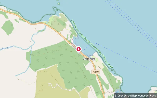
Craignure put-in, west side of the bay
Argyll and Bute, ScotlandThis second slipway is on the western side of Craignure Bay, just off the A849 a short distance from the main ferry pier, still on the Sound of Mull side of Mull's east coast.
Save your own spots
Keep the places you launch, check the wind and shelter before you go, and log every paddle. Add a spot to the directory too, and other paddlers will find it. Free to start.
Some launch spots in this directory are seeded from open data. © OpenStreetMap contributors · Open Database Licence (ODbL) · Machine-readable copy