Paddleboarding spots in Hampshire
107 launch spots across Hampshire
Every mapped spot in Hampshire
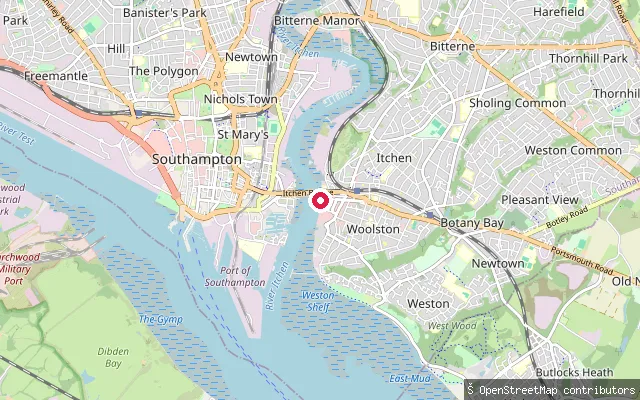
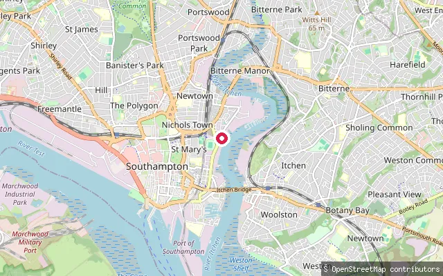
Zoom in to split a cluster; open a pin for the spotMap of every spot in Hampshire
The interactive map opens on any device with JavaScript. The full list of launch spots is below.
Launch spots
Showing 24 of 107
LakeFleet Pond Slipway (Boat House Corner)
Hampshire, EnglandFleet Pond is a 48-hectare lake in Fleet, Hampshire, the largest freshwater body in the county and a Site of Special Scientific Interest since 1951. This slipway sits at Boat House Corner, added as part of the Fleet Pond Corridor improvement works. Hart District Council issues boating permits for the reserve, with boating allowed between 16 June and 14 March under its fishing and boating policy.
SeaOwer foreshore slipway, Fawley
Hampshire, EnglandThis slip sits on the Southampton Water shore at Ower, in Fawley parish, on the site of the former Fawley Power Station, which closed in 2013 and was largely demolished between 2019 and 2023. A redevelopment of the site, Fawley Waterside, was proposed but shelved in 2024.
SeaCalshot Castle foreshore
Hampshire, EnglandThis point sits on Calshot Spit near Calshot Castle, a circular artillery fort built in 1539 by Henry VIII to guard the entrance to Southampton Water. The surrounding foreshore forms part of Hampshire County Council's Calshot site, with pay-and-display parking nearby.
SeaAshlett Creek put-in (Fawley)
Hampshire, EnglandThis slipway is on Ashlett Creek in the hamlet of Ashlett near Fawley, about 150 metres from the well-known Ashlett Hard slip, and gives onto the same tidal creek that opens into Southampton Water.
SeaFawley put-in (New Forest)
Hampshire, EnglandThis slipway lies on Southampton Water near Ower, within the site of the former Fawley Power Station, which is being redeveloped into the Fawley Waterside marina and town scheme. OpenStreetMap tags the slipway access=private.
SeaCalshot Spit slipway (Fawley)
Hampshire, EnglandThis slipway sits on Calshot Spit, the shingle bank at the mouth of Southampton Water off Fawley, close to Calshot Activities Centre. Hampshire County Council runs a launch and storage membership scheme here with three, six and twelve-month launch passes, and OpenStreetMap marks the point as a small-craft facility.
SeaEmsworth slipway
Hampshire, EnglandThis slipway is by a boat storage yard on Emsworth's waterfront, at the head of the Emsworth Channel, the northernmost of Chichester Harbour's three main channels. The town's harbour basin fills at high tide and drains through sluice gates as the tide falls.
SeaEastoke slipway, Hayling Island
Hampshire, EnglandThis slipway is on Marine Walk in Eastoke, the built-up south-eastern corner of Hayling Island, launching onto Hayling Bay, the open sea off the island's south coast. It lies a short distance west of the approach to Chichester Harbour's entrance.
SeaEastoke slipway, Hayling Island (Seafarers Walk)
Hampshire, EnglandThis slipway is on Seafarers Walk in Eastoke, near Hayling Island's eastern tip at Sandy Point, launching towards the mouth of Chichester Harbour. The harbour entrance here is shallow and includes Chichester Bar, which the harbour authority describes as a navigation hazard at all states of the tide.
RiverFairthorne Manor slipway (Curdridge)
Hampshire, EnglandThis launch point is the pontoon and slipway at Fairthorne Manor, a YMCA outdoor centre on the upper, non-tidal River Hamble near Curdridge. Self-launch costs 5.50 pounds per craft per visit, stand-up paddleboard hire runs seasonally from April to September, and under-18s must be accompanied on the water.
SeaClayhall put-in (Gosport)
Hampshire, EnglandThis slipway sits by Haslar Bridge in Clayhall, on the Gosport side of Portsmouth Harbour's entrance. It launches onto Haslar Lake, the tidal reach of Haslar Creek that runs past Haslar Marina before opening into the harbour. The Joint Services Adventurous Sail Training Centre operates from the same stretch of bank.
SeaClayhall put-in (Gosport)
Hampshire, EnglandThis slipway sits on the Solent shore near Fort Gilkicker, at the eastern tip of Stokes Bay in Gosport, close to the approach to Portsmouth Harbour. Clayhall, the Gosport neighbourhood the name refers to, lies just inland of this stretch of coast.
SeaChilling slipway, near Warsash
Hampshire, EnglandThis slip sits on the Southampton Water shore at Chilling, a small hamlet on the Solent Way south of Warsash, next to the Solent Breezes caravan park. The Hook-with-Warsash Local Nature Reserve, a Hampshire County Council reserve of mudflats, saltmarsh and grazing marsh on the Hamble estuary and Southampton Water, lies immediately to the north.
RiverRiverside Boatyard slipway, Lowford (Bursledon)
Hampshire, EnglandThis slipway lies within or immediately beside Riverside Boatyard's grounds at Lowford, on the River Hamble close to the M27 crossing north of Bursledon Bridge. The boatyard offers moorings, a 30-tonne boat lift and a chandlery run from a converted WWII concrete barge; general public access to the slip itself is not confirmed.
RiverBotley slipway
Hampshire, EnglandThis slipway at Botley sits close to the practical head of navigation on the River Hamble, where the tidal reach meets an ancient watermill. Parking is limited to about two cars with a short walk to the water, and paddlers can only reach or leave Botley within a couple of hours either side of high tide.
SeaSowley shore slipway (private)
Hampshire, EnglandThis is a private gravel slipway on the Solent shore within the Sowley and Pylewell Park Estate. It lies several miles from the village of Boldre, which the harvester's guessed water body name was mistakenly drawn from.
SeaBedhampton put-in (Havant)
Hampshire, EnglandThis slipway is off Harts Farm Way in Bedhampton, at the northern end of Langstone Harbour where the village sits at the foot of Portsdown Hill's eastern end. Southmoor local nature reserve, which floods at high tide, lies close by on the harbour's edge. Langstone Harbour Board requires a permit and harbour dues for all craft using the harbour, including paddlers.
SeaBedhampton put-in (Havant)
Hampshire, EnglandThis slipway is off Harts Farm Way in Bedhampton, at the northern end of Langstone Harbour where the village sits at the foot of Portsdown Hill's eastern end. Southmoor local nature reserve, which floods at high tide, lies close by on the harbour's edge. Langstone Harbour Board requires a permit and harbour dues for all craft using the harbour, including paddlers.
RiverHermitage Stream access, Bedhampton
Hampshire, EnglandThis point sits beside Hermitage Stream on Staunton Road in Bedhampton, a suburb of Havant at the foot of Portsdown Hill. The stream is a small watercourse, mapped at only about 2.5 metres wide, that runs through the Hermitage Stream Walk green corridor before eventually reaching Langstone Harbour.
RiverBeaulieu River slipway (St Leonards)
Hampshire, EnglandThis is a slipway on the tidal Beaulieu River near St Leonards, about 2km downstream of Buckler's Hard. The Beaulieu Estate permits paddlers to launch only from the slipway at Buckler's Hard Yacht Harbour, so this bank slipway more likely serves a private riverside mooring than public paddling access.
RiverBeaulieu River slipway (Keeping Marsh)
Hampshire, EnglandThis is a slipway on the tidal Beaulieu River at Keeping Marsh, close to Buckler's Hard. The Beaulieu Estate permits paddlers to launch only from the slipway at Buckler's Hard Yacht Harbour, so this marshside slipway more likely serves a private mooring than public access.
RiverBeaulieu River slipway (Gravelly Marsh)
Hampshire, EnglandThis is a slipway on the tidal Beaulieu River at Gravelly Marsh, further downstream toward the river's mouth on the Solent. The Beaulieu Estate permits paddlers to launch only from the slipway at Buckler's Hard Yacht Harbour, so this downstream slipway more likely serves a private mooring than public access.
RiverBuckler's Hard slipway, Beaulieu River
Hampshire, EnglandBuckler's Hard Yacht Harbour's slipway is the only point on the privately owned Beaulieu River where the estate permits paddlers to launch or land a canoe, kayak or paddleboard. The estate charges a launch fee and takes online slot bookings, and the ramp dries out steeply so should be avoided for two hours either side of low water.
CanalBarley Mow Slipway
Hampshire, EnglandThe Barley Mow Slipway launches onto the Basingstoke Canal at Winchfield, next to the canalside Barley Mow pub, with a free car park on Sprat's Hatch Lane that closes at 8pm in summer and 6pm in winter. The Basingstoke Canal Authority requires a licence for private canoes, kayaks and paddleboards on the canal, though Paddle UK members are covered by their membership. This stretch is part of a Site of Special Scientific Interest noted for its aquatic plants and dragonflies.
Save your own spots
Keep the places you launch, check the wind and shelter before you go, and log every paddle. Add a spot to the directory too, and other paddlers will find it. Free to start.
Some launch spots in this directory are seeded from open data. © OpenStreetMap contributors · Open Database Licence (ODbL)