Log in

Paddleboarding spots in Cumbria

67 launch spots across Cumbria

Every mapped spot in Cumbria

Zoom in to split a cluster; open a pin for the spot

Map of every spot in Cumbria

The interactive map opens on any device with JavaScript. The full list of launch spots is below.

Launch spots

Showing 19 of 67
Whitehaven put-inSea

Whitehaven put-in

Cumbria, England

Whitehaven Harbour is a Georgian-era harbour on the west Cumbrian coast, developed from 1634 as a coal-exporting port and now home to a marina with around 400 berths. This slipway sits within the harbour complex, close to the Edge Whitehaven activity hub which runs paddleboarding sessions from the harbourside.

Whitehaven put-inSea

Whitehaven put-in

Cumbria, England

Whitehaven Harbour is a Georgian-era harbour on the west Cumbrian coast, developed from 1634 as a coal-exporting port and now home to a marina with around 400 berths. This slipway sits at the southern end of the harbour close to a near-identical mapped point, likely recording the same launch spot twice.

Silecroft Beach slipway, WhichamSea

Silecroft Beach slipway, Whicham

Cumbria, England

This slipway opens onto Silecroft Beach on the Whicham parish coast, a gently shelving shingle-and-sand beach facing the Irish Sea with the Cumbria Coastal Way running along it. Free parking sits beside the beach, with toilets and village pubs nearby.

Armboth slipway (Thirlmere)Lake

Armboth slipway (Thirlmere)

Cumbria, England

A slipway on Thirlmere reservoir's western shore, reached from the Armboth car park off Dam Road near Legburthwaite. United Utilities, which owns the reservoir, lists canoeing as permitted at Thirlmere but does not permit paddleboarding there.

St. Bees put-inSea

St. Bees put-in

Cumbria, England

St Bees Beach is a broad sandy beach on the Irish Sea coast at the southern end of the Cumbrian coastline, beneath the red sandstone cliffs of St Bees Head. It is the traditional starting point of Wainwright's Coast to Coast Walk, and a slipway here gives access to the beach for launching craft.

Silloth coast path slipwaySea

Silloth coast path slipway

Cumbria, England

A slipway on the concrete coast path north-east of Silloth, on the stretch of the King Charles III England Coast Path heading towards Grune Point. It fronts the Solway Firth's tidal sand and mudflats, which shift daily under one of the UK's largest tidal ranges.

Silloth pier slipwaySea

Silloth pier slipway

Cumbria, England

A slipway beside a small pier on the concrete promenade path north-east of Silloth, on the King Charles III England Coast Path towards Grune Point. It launches onto the Solway Firth's tidal sand and mudflats, which are exposed and re-covered by one of the UK's largest tidal ranges.

Silloth RNLI slipwaySea

Silloth RNLI slipway

Cumbria, England

A slipway at Silloth's RNLI lifeboat station on the Solway Firth, on the north-west Cumbrian coast facing the Galloway hills across the water. The Solway has one of the largest tidal ranges in the UK, with spring tides at Silloth rising and falling by around 8.4 metres, so the exposed sand and mudflats here change fast with the tide.

Seascale put-inSea

Seascale put-in

Cumbria, England

This second slipway sits a short distance south along Seascale's seafront on the Irish Sea coast, near South Parade. Like the rest of the beach it shelves from shingle to sand, backed by the village's seafront car park and facilities.

Seascale put-inSea

Seascale put-in

Cumbria, England

This slipway sits on Seascale's beach on the Irish Sea coast, next to the seafront car park. The beach shelves from shingle at the top to a wide expanse of sand at low tide, with toilets and a convenience store nearby.

Parton put-inSea

Parton put-in

Cumbria, England

Parton is a small coastal village on the Cumbrian coast about two miles north of Whitehaven, overlooking the Solway Firth. A slipway gives access to a beach that is mainly pebbles and rock, with sand exposed at low tide, reached from the village via a tunnel under the railway line.

Hodbarrow Outer Barrier slipway, HaveriggSea

Hodbarrow Outer Barrier slipway, Haverigg

Cumbria, England

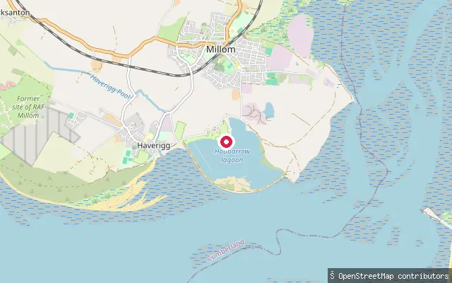
This slipway is on the Hodbarrow Outer Barrier near Haverigg, a sea wall over a mile long built between 1900 and 1905 to keep the sea from the former Hodbarrow ironstone workings, and opens onto the Duddon Estuary. The estuary forms part of a Site of Special Scientific Interest and is Cumbria's second-largest after the Solway Firth.

Hodbarrow Lagoon slipway, Outer BarrierLake

Hodbarrow Lagoon slipway, Outer Barrier

Cumbria, England

This slipway launches onto Hodbarrow Lagoon, a flooded former ironstone mine enclosed by the Hodbarrow Outer Barrier near Haverigg and now run by the RSPB as a nature reserve on the edge of the Duddon Estuary. The RSPB protects the lagoon from boats and visitors during the bird breeding season.
Hodbarrow Lagoon slipway, Steel GreenLake

Hodbarrow Lagoon slipway, Steel Green

Cumbria, England

This slipway is at Steel Green, Haverigg, and launches onto Hodbarrow Lagoon, a flooded former ironstone mine enclosed by the Hodbarrow Outer Barrier and now an RSPB nature reserve on the edge of the Duddon Estuary. The RSPB protects the lagoon from boats and visitors during the bird breeding season.

Keswick put-inLake

Keswick put-in

Cumbria, England

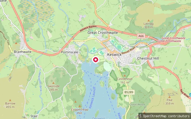
This slipway launches onto the north shore of Derwentwater near Crow Park Road on the edge of Keswick. Keswick Boat Landings, close by, is used as a launch point for paddleboarding trips out towards the lake's islands.
Keswick Launch slipway (Derwentwater)Lake

Keswick Launch slipway (Derwentwater)

Cumbria, England

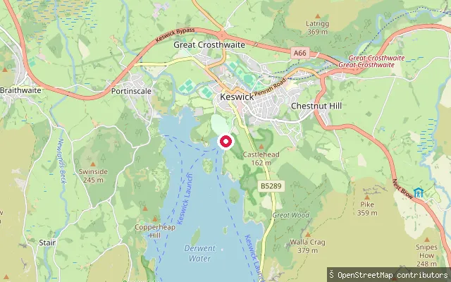
A slipway beside the Keswick Launch ticket office on Derwentwater's northern shore in Keswick town centre. Canoes, kayaks and paddleboards are permitted on the lake, though landing is restricted on some of its islands.

Talkin Tarn slipwayLake

Talkin Tarn slipway

Cumbria, England

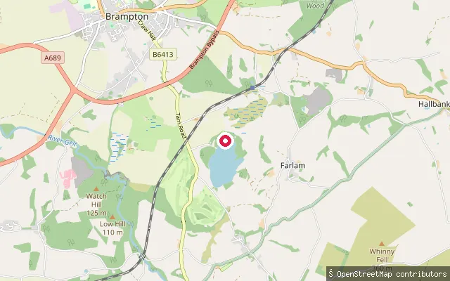
A slipway on Talkin Tarn, a 65-acre glacial lake in a country park about two miles south of Brampton. The park is home to Brampton Sailing Club and Talkin Tarn Amateur Rowing Club, and Cumberland Council charges a launch permit for craft brought onto the water, including canoes, kayaks and paddleboards.

Beckermet put-inRiver

Beckermet put-in

Cumbria, England

This slipway lies on the River Ehen close to Beckermet village, on the stretch that flows on past Sellafield to the Cumbrian coast. OpenStreetMap marks this reach of the river access=no and boat=no, and broader guidance for the Ehen describes stretches of private fishing land and a protected freshwater pearl mussel population further upstream.

Portinscale slipwayLake

Portinscale slipway

Cumbria, England

This slipway sits on the western shore of Derwentwater at Portinscale, within the Above Derwent civil parish that gave the harvested name to this site. It lies close to the Derwentwater Marina and Nichol End Marine hire centres, both of which launch canoes, kayaks and paddleboards onto the lake.

Save your own spots

Keep the places you launch, check the wind and shelter before you go, and log every paddle. Add a spot to the directory too, and other paddlers will find it. Free to start.

Some launch spots in this directory are seeded from open data. © OpenStreetMap contributors · Open Database Licence (ODbL)